LiDAR point cloud video processing software
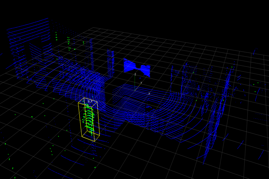
pylidartracker is a desktop traffic analysis software for pre-processing point cloud videos captured by a static VelodyneHDL LiDAR (so far only HDL32). Pre-processed clouds can be clustered into road users whose tracks can be exported for further analysis. The software is developed at Aalborg University Denmark, Traffic Research Group and was first used in the master thesis on the assessment of LiDAR technology for cyclist detection source in Danish. To try the application, visit the associated github page.
Features
- Open UDP Network stream
.pcapfiles captured by Velodyne for preview. - pre-processing/editing in terms of coordinate transformation, clipping, background subtraction, clustering and cluster tracking.
- Save project configuration files that can be applied to the files from similar experimental setup to improve reproducibility and avoid repetitive steps in the analysis process.
- Output
.jsonfile with detected road user ID, time and position per point cloud video frame.